Route Simulation With Instructions
In this guide you will learn how to simulate navigation
along a computed route rendered on an interactive map,
from a departure position to a desired destination.
The map is fully 3D, supporting pan, pinch-zoom,
rotate and tilt.
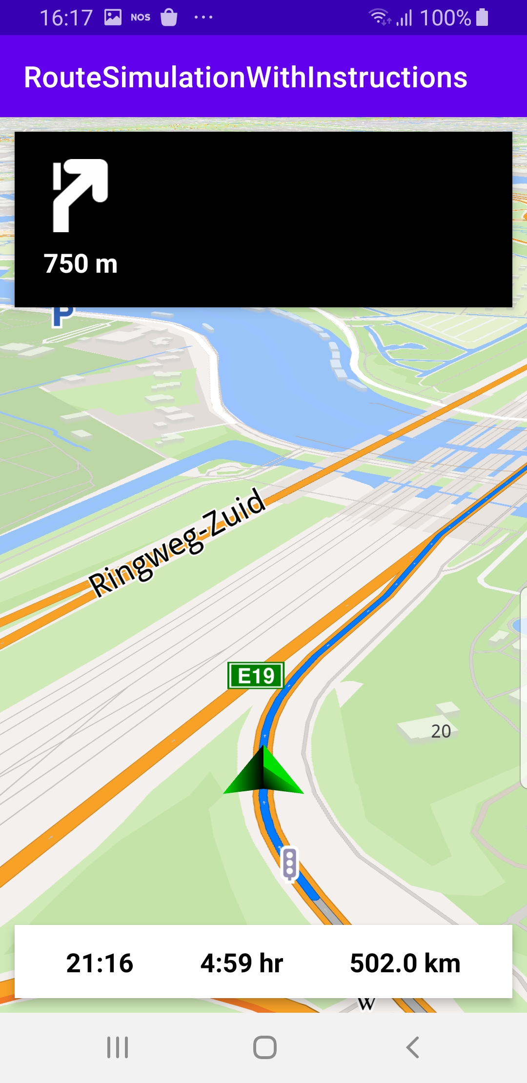
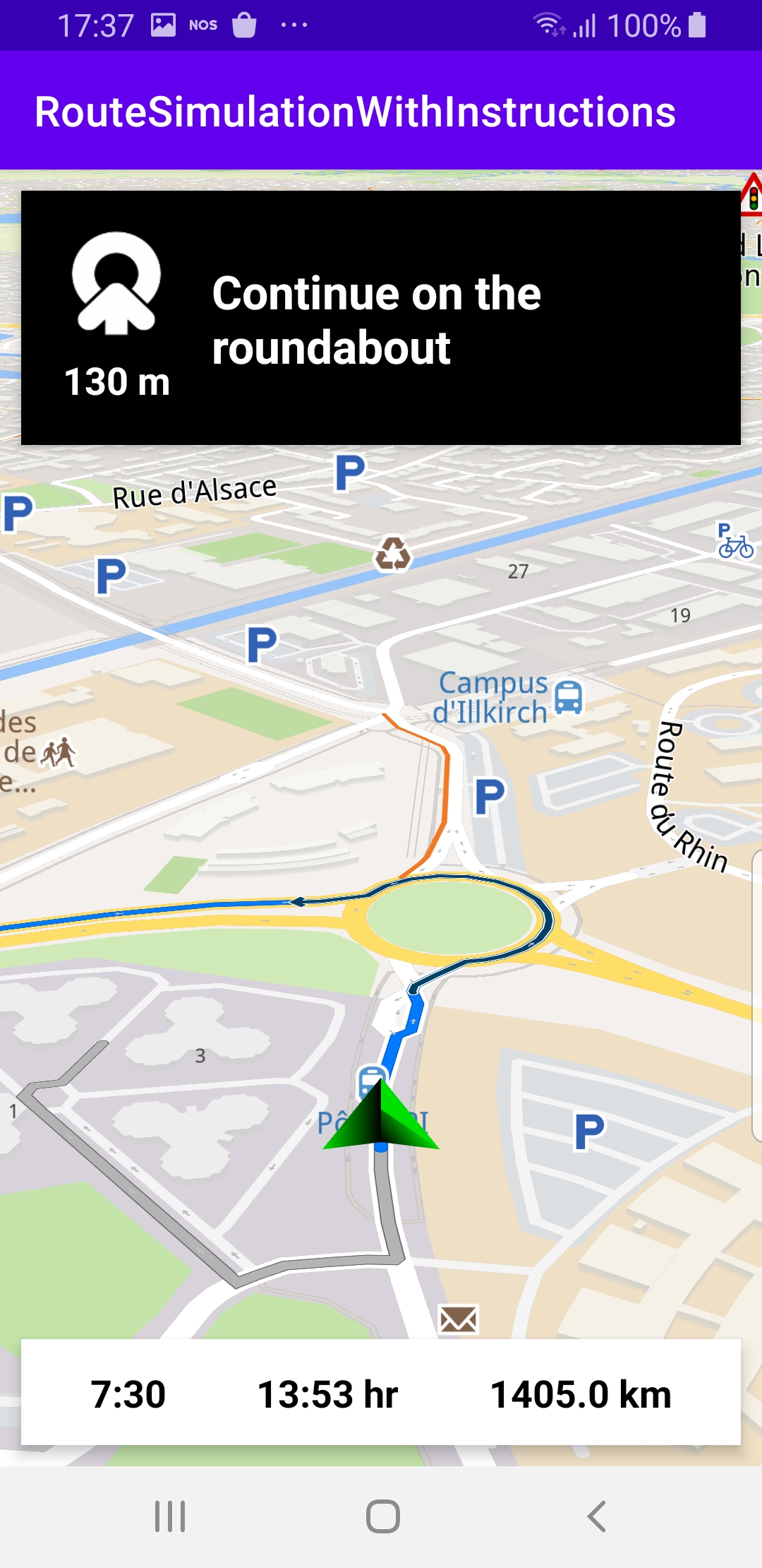
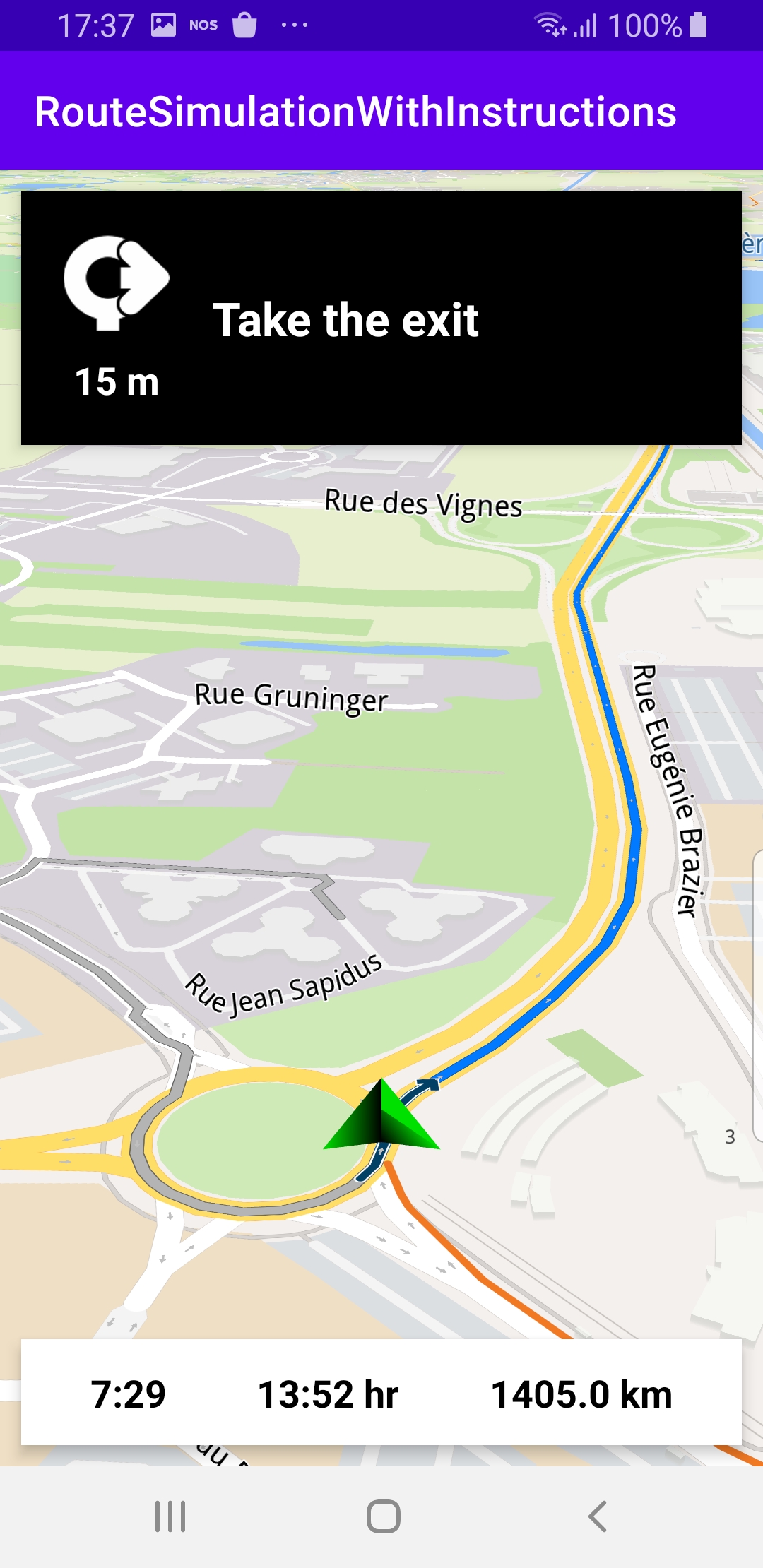
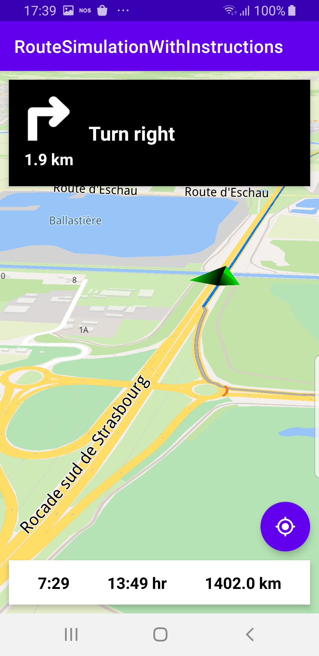
The navigation includes on-screen text and turn arrow
instructions in a panel at the top, as well as a
bottom panel showing estimated time of arrival (ETA)
at the destination, remaining trip time,
and remaining travel distance.
Setup
First, get an API key token, see the
Getting Started guide.
Download the RouteSimulationWithInstructions project archive file or clone the project with Git
See the Configure Android Example guide.
Run the example
In Android Studio, from the File menu, select Sync Project with Gradle Files
|
|
|
An android device should be connected via USB cable.
Press SHIFT+F10 to compile, install and run the example on the
android device.
How it works
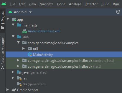
You can open the MainActivity.kt file to see how simulated navigation along a computed route with turn arrow and text instructions works.
1private val navigationService = NavigationService()
A NavigationService() is instantiated, which carries out
both simulated navigation and real navigation.
 1private val navigationListener: NavigationListener = NavigationListener.create(
 2     onNavigationStarted = {
 3         SdkCall.execute {
 4             gemSurfaceView.mapView?.let { mapView ->
 5                 mapView.preferences?.enableCursor = false
 6                 navRoute?.let { route ->
 7                     mapView.presentRoute(route)
 8                 }
 9                 enableGPSButton()
10                 mapView.followPosition()
11             }
12         }
13         topPanel.visibility = View.VISIBLE
14         bottomPanel.visibility = View.VISIBLE
15     },
16     onNavigationInstructionUpdated = { instr ->
17         var instrText = ""
18         var instrIcon: Bitmap? = null
19         var instrDistance = ""
20         var etaText = ""
21         var rttText = ""
22         var rtdText = ""
23         SdkCall.execute {
24             // Fetch data for the navigation top panel (instruction related info).
25             instrText = instr.nextStreetName ?: ""
26             instrIcon = instr.nextTurnImage?.asBitmap(100, 100)
27             instrDistance = instr.getDistanceInMeters()
28             // Fetch data for the navigation bottom panel (route related info).
29             navRoute?.apply {
30                 etaText = getEta() // estimated time of arrival
31                 rttText = getRtt() // remaining travel time
32                 rtdText = getRtd() // remaining travel distance
33             }
34         }
35         // Update the navigation panels info.
36         navInstruction.text = instrText
37         navInstructionIcon.setImageBitmap(instrIcon)
38         navInstructionDistance.text = instrDistance
39         eta.text = etaText
40         rtt.text = rttText
41         rtd.text = rtdText
42     }
43)
The
NavigationListener receives event updates from the navigation service
during navigation or simulation on a route, such as
when the destination is reached, or when the route to the desired destination
has been recomputed, because a detour away from the original route was taken.The top navigation panel displays the turn arrow icon,
instrIcon,
distance, instrDistance, and an optional instruction, instrText.The bottom navigation panel contains ETA - estimated time of arrival,
etaText,
rtt - remaining travel time, rttText, and
rtd - remaining travel distance, rtdText.Besides the
onNavigationStarted listener, the
onNavigationInstructionUpdated listener is also instantiated,
to receive the turn arrow and text instructions for turns
and other events along the route.1private val routingProgressListener = ProgressListener.create(
2 onStarted = {
3 progressBar.visibility = View.VISIBLE
4 },
5 onCompleted = { _, _ ->
6 progressBar.visibility = View.GONE
7 },
8 postOnMain = true
9)
Define a listener to indicate when the route computation is completed,
so real or simulated navigation (simulated in this case) can start.
When navigation is started,
mapView.followPosition() causes
the camera to follow the green arrow.If the user pans (moves) the map to another location,
the camera no longer follows the green arrow.
|
|||
 1private fun enableGPSButton() {
 2     // Set actions for entering/ exiting following position mode.
 3     gemSurfaceView.mapView?.apply {
 4         onExitFollowingPosition = {
 5             followCursorButton.visibility = View.VISIBLE
 6         }
 7         onEnterFollowingPosition = {
 8             followCursorButton.visibility = View.GONE
 9         }
10         // Set on click action for the GPS button.
11         followCursorButton.setOnClickListener {
12             SdkCall.execute { followPosition() }
13         }
14     }
15}
enableGPSButton() causes a round purple button to appear in the lower
right corner of the screen, whenever the simulation is active and
the camera is not following the green arrow. If the user pushes this button,
the followPosition() function is called, and thus the camera
starts to follow the green arrow once again.1private fun startSimulation() = SdkCall.execute {
2 val waypoints = arrayListOf(
3 Landmark("Start", 48.526, 7.734),
4 Landmark("Destination", 41.645, -0.883)
5 )
6 navigationService.startSimulation(waypoints, navigationListener, routingProgressListener)
7}
The starting, or departure point of the route is the first waypoint in a list of
2 or more Landmarks (2 in this case), each containing a name, latitude (in degrees)
and longitude (in degrees). The destination point is the last waypoint in the list.
 1override fun onCreate(savedInstanceState: Bundle?) {
 2     super.onCreate(savedInstanceState)
 3     setContentView(R.layout.activity_main)
 4     gemSurfaceView = findViewById(R.id.gem_surface)
 5     progressBar = findViewById(R.id.progressBar)
 6     followCursorButton = findViewById(R.id.followCursor)
 7
 8     topPanel = findViewById(R.id.top_panel)
 9     navInstruction = findViewById(R.id.nav_instruction)
10     navInstructionDistance = findViewById(R.id.instr_distance)
11     navInstructionIcon = findViewById(R.id.nav_icon)
12
13     bottomPanel = findViewById(R.id.bottom_panel)
14     eta = findViewById(R.id.eta)
15     rtt = findViewById(R.id.rtt)
16     rtd = findViewById(R.id.rtd)
17
18     SdkSettings.onMapDataReady = onMapDataReady@{ isReady ->
19         if (!isReady) return@onMapDataReady
20         // Defines an action that should be done
21         // when the world map is ready (Updated/ loaded).
22         startSimulation()
23     }
24     SdkSettings.onApiTokenRejected = {
25         Toast.makeText(this@MainActivity, "TOKEN REJECTED", Toast.LENGTH_SHORT).show()
26     }
27     if (!Util.isInternetConnected(this)) {
28         Toast.makeText(this, "You must be connected to internet!", Toast.LENGTH_LONG).show()
29     }
30}
The
MainActivity overrides the onCreate() function which checks that
internet access is available, connects the top panel to enable displaying
the turn arrow icon, distance and an optional instruction, and also connects
the bottom panel to enable displaying the ETA, remaining travel time and distance,
and then, when the map is instantiated and ready, starts the simulation.